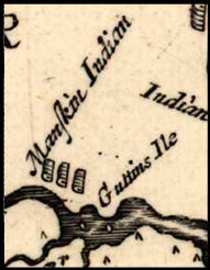
1670 Herman
Augustin
Herrman labels the Island as “Guttins” Ile”.
At this time it was now know as “Goddins Island”
and he even draws the houses of the Manskin
Indians living on it. The indians could be
living on the island, or just north of it.
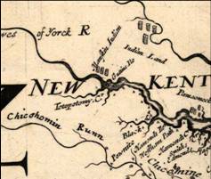
Two
small dots in the center of the river represent
islands near New Castle Ferry and Monquin
Creeks. Maps at this time were built from text
descriptions rather than mapping out a grid.