
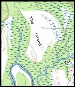
1700s show single
Island

1751 Fry
1781
Chesnoy
1751 Fry and 1781 Chesnoy and 1755 Vaugondy come from the
same stock. They all have a single
large round floating island.
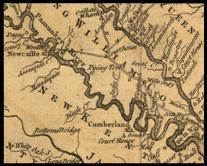
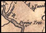
Manquin Creek and Matedequin Creek are drawn as being almost across the creek from each other, which show reliance on the same verbal descriptions. Matedequin Creek is actually below Piping Tree.

These three maps show a single large island and I believe these two maps are based on the verbal descriptions of “The Island” as opposed to canoe trips at high tide around creeklets.

1755
Vaugondy


