
1920 Army Engineers
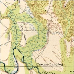

2006 USGS Map shows
Upper Pampatke running along causeway
halfway. It currently runs the entire
length.
The top of Piping Tree
Creek is show as rerouted over to Pampatike
Creek, but it travels along base of Shop
Spring Hill instead of along the causeway
as it does now.
Pampatike is shown in
original location even though it now
exits at a new location. (Same as Blackford)


2006 USGS Map