
1680 Johannes Van Keulen
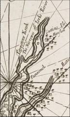
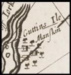

Johannes
Van Keulen also shows “The
Island” as “Guttins Ile”. He draws the village surrounded by trees. Very Similar to Herman.
So the
question is, are all these
maps showing the Manskin
Indians in this location
simply because everybody kept
copying Herman?
The
Langstrom map predates Herman
but labels the Island as
“Menmend” but he does name
Totpotomoy Creek as Manskin
Creek, thus independently
confirming the tribes name.